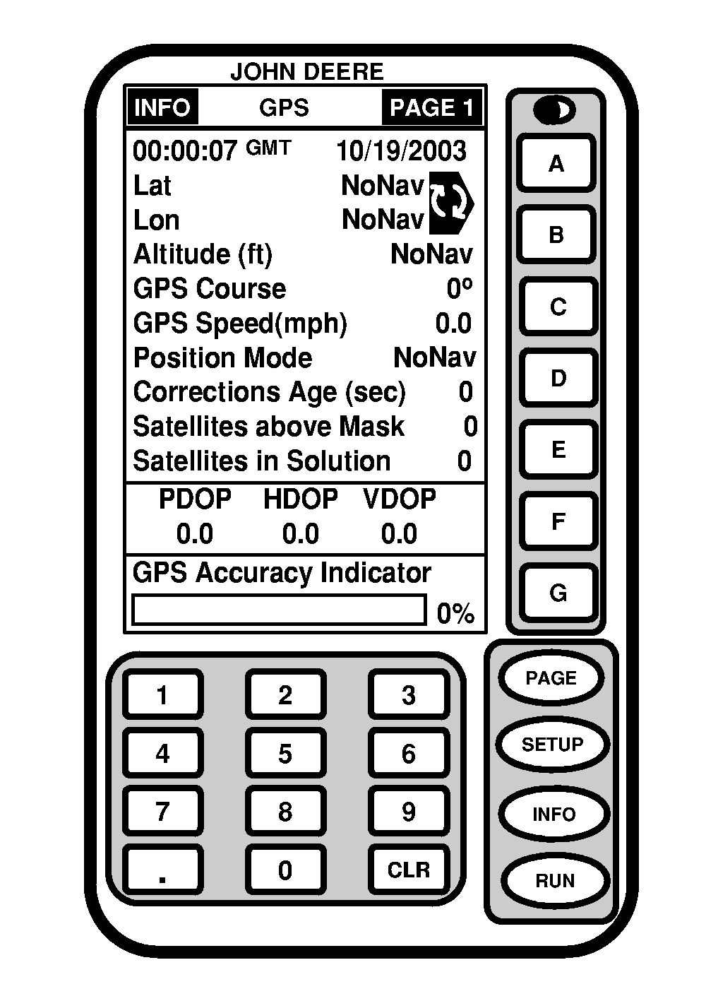
INFO - GPS - PAGE 1Screen: INFO - GPS - PAGE 1 Press: INFO >> STARFIRE RECEIVER Press PAGE button to access additional pages. This screen shows information and status of incoming GPS and differential correction signals. No information on this screen can be changed. It is for viewing only. Date and TimeThis cell shows date and time for Greenwich Mean time. LatThis cell displays vehicle location latitude coordinates with respect to Equator (north or south). LonThis cell shows vehicle location longitude coordinates with respect to Prime Meridian (east or west). AltitudeThis cell shows height of receiver in meters (feet) above sea level. GPS CourseNOTE: Course and speed normally show small speeds and various courses even when machine is not moving. This cell displays direction of travel, in degrees, relative to true north (zero degrees) as measured by receiver. Angle is measured in clockwise direction. GPS SpeedThis cell shows ground speed of machine in kilometers per hour (mile per hour) as measured by receiver. |
|
OUO6050,0000720 -19-10JUN04-1/3 |
|
Position Mode
This cell shows status of GPS signal: 2-D (two dimensional with latitude and longitude of vehicle) or 3-D (three dimensional with altitude, latitude, and longitude of vehicle). Position mode cell also shows status of differential signal: SF 1 (StarFire 1 differential), SF 2 (StarFire 2 differential). Corrections Age (SEC)This cell shows age of differential correction signal to GPS (normally less than 10 seconds). Sats Above MaskThis is the total number of GPS satellites available to your receiver that are above 7 degree elevation mask. Satellites in SolutionThis cell shows number of satellites actively used to compute position. PDOP, HDOP and VDOPThis cell shows precision of GPS position signal. Precision of signal is affected by geometry of satellites being used.
Version 7.00 and greater StarFire receiver software includes GPS Accuracy Indicator (GPS AI). GPS AI gives an indication of GPS position accuracy achieved by StarFire receiver, and is displayed as a percentage (0-100%). GPS AI is displayed on RUN Page of Parallel Tracking (Figure 1), AutoTrac, and Field Doc and INFO › GPS › Page 1 screen (Figure 2). |
OUO6050,0000720 -19-10JUN04-2/3 |
|
When receiver is initially powered, GPS AI will display 0%. As receiver acquires satellites and calculates a position, GPS AI will increase as accuracy improves. Acceptable guidance performance for Parallel Tracking and AutoTrac is achieved when GPS AI displays 80% or greater. This may take up to 20 minutes. GPS accuracy is affected by many factors. If 80% accuracy or greater is not achieved within 25 minutes, consider following possibilities:
|
OUO6050,0000720 -19-10JUN04-3/3 |