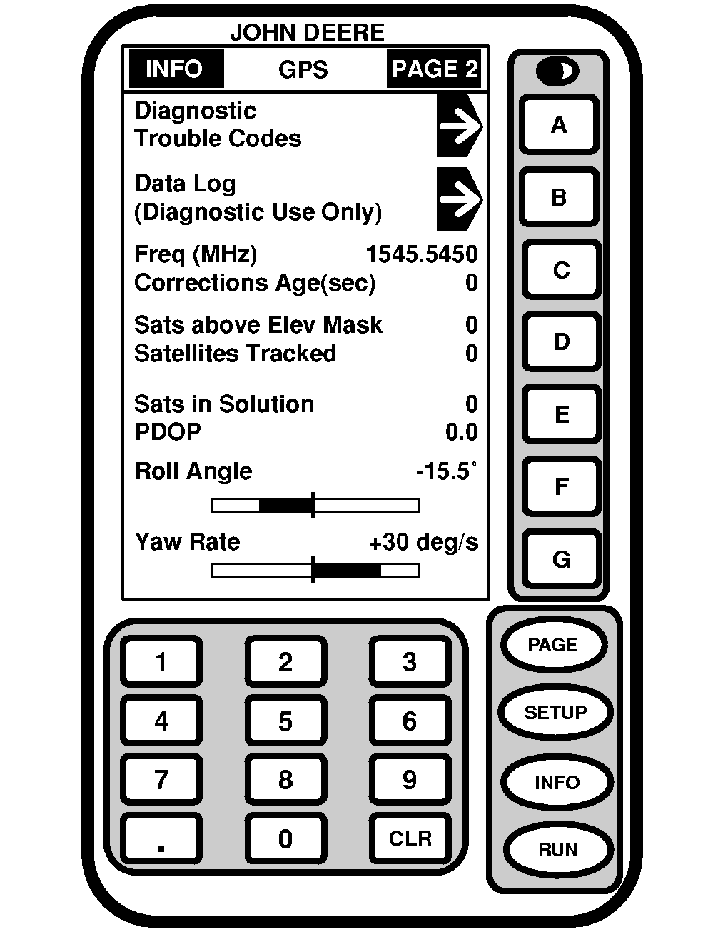
INFO - GPS - PAGE 2Screen: INFO - GPS - PAGE 2 Press: INFO >> STARFIRE ITC >> PAGE Diagnostic Trouble Codes: (See DIAGNOSTIC TROUBLE CODES in Troubleshooting section.) Data Log: Three data log pages consist of graphs showing GPS information for up to previous 60 minutes. Graphs can be used to show user any variation that has occurred in last 60 minutes. Freq (MHz): This cell shows frequency of differential correction signal that receiver is set to receive. Corrections Age (SEC): This cell shows age of differential correction signal to GPS (normally less than 10 seconds). Sats Above Elev Mask: This is total number of GPS satellites available to your receiver that are above 7° elevation mask. Satellites Tracked: This is total number of GPS satellites tracked by your receiver. Satellites in Solution: This cell shows number of satellites actively used to compute position. PDOP: PDOP (Position Dilution of Precision) is an indicator of GPS satellite geometry as viewed by receiver. A lower PDOP indicates better satellite geometry for calculating both a horizontal and vertical position. Roll Angle: Is both graphical and numerical representation of amount of roll TCM is measuring, relative to calibrated zero degree reference. A positive roll angle means vehicle is rolled to right. Yaw Rate: This gives a graphic representation and a numeric figure for amount of rotation TCM is measuring. Positive yaw rate means vehicle is turning to right. |
|
JS56696,00005C7 -19-13MAY09-1/1 |