NMEA Messages
PC21210-UN-28MAY15
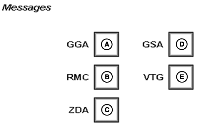
A - GGA
B - RMC
C - ZDA
D - GSA
E - VTG
Select NMEA string outputs.NMEA Strings
NMEA has developed a specification that defines the interface between pieces of electronic equipment.
NOTE: To use NMEA data, purchase a radar harness kit.
GGA (A)–Essential fix data which provide 3D location and accuracy data.
GGA string example:
$GPGGA,123519,4807.038,N,01131.000,
E,1,08,0.9,545.4,M,46.9,M,,*47
Where:
|
GGA |
Global Positioning System Fix Data |
|
123519 |
Fix taken at 12:35:19 UTC |
|
4807.038,N |
Latitude 48 degrees 07.038' N |
|
01131.000,E |
Longitude 11 degrees 31.000' E |
|
1 |
Fix quality: 0 = Invalid 1 = GPS fix (SPS) 2 = DGPS fix 3 = PPS fix 4 = Real Time Kinematic 5 = Float RTK 6 = Estimated (dead reckoning) 7 = Manual input mode 8 = Simulation mode |
|
08 |
Number of satellites being tracked |
|
0.9 |
Horizontal dilution of position |
|
545.4,M |
Altitude, Meters, above mean sea level |
|
46.9,M |
Height of geoid (mean sea level) above WGS84 |
RMC (B)–NMEA has its own version of essential GPS PVT (position, velocity, time) data. It is called RMC, the Recommended Minimum.
RMC string example:
$GPRMC,123519,A,4807.038,N,01131.000,
E,022.4,084.4,230394,003.1,W*6A
Where:
|
RMC |
Recommended Minimum sentence C |
|
123519 |
Fix taken at 12:35:19 UTC |
|
A |
Status A=active or V=Void. |
|
4807.038,N |
Latitude 48 deg 07.038' N |
|
01131.000,E |
Longitude 11 deg 31.000' E |
|
022.4 |
Speed over the ground in knots |
|
084.4 |
Track angle in degrees True |
|
230394 |
Date - 23rd of March 1994 |
|
003.1,W |
Magnetic Variation |
|
*6A |
The checksum data, always begins with * |
ZDA (C)–Data and Time
ZDA string example:
$GPZDA,hhmmss.ss,dd,mm,yyyy,xx,yy*CC
$GPZDA,201530.00,04,07,2002,00,00*6E
Where:
|
hhmmss |
Hour, Minute, Second |
|
dd,mm,yyy |
Day, Month, Year |
|
xx |
local zone hours -13..13 |
|
yy |
local zone minutes 0..59 |
|
*CC |
checksum |
GSA (D)–GPS dilution of precision (DOP) and active satellites. This sentence provides details on the nature of the satellite constellation fix. It includes the numbers of the satellites being used in the current solution and the DOP. DOP is an indication of the effect of satellite geometry on the accuracy of the fix. It is a unitless number where smaller is better. For 3D fixes using four satellites a 1.0 would be considered to be a perfect number. For overdetermined solutions, it is possible to see numbers below 1.0.
GSA string example:
$GPGSA,A,3,04,05,,09,12,,,24,,,,,2.5,1.3,2.1*39
Where:
|
GSA |
Satellite status |
|
A |
Auto selection of 2D or 3D fix (M = manual) |
|
3 |
3D fix - values include:: 1 = no fix 2 = 2D fix 3 = 3D fix |
|
04,05,,09,12,,,24,,,,, |
PRNs of satellites used for fix (space for 12) |
|
2.5 |
PDOP (dilution of precision) |
|
1.3 |
Horizontal dilution of precision (HDOP) |
|
2.1 |
Vertical dilution of precision (VDOP) |
|
*39 |
The checksum data, always begins with * |
VTG (E)–Velocity made good. The GPS receiver may use the LC prefix instead of GP if it is emulating Loran output.
VTG string example:
$GPVTG,054.7,T,034.4,M,005.5,N,010.2,K*33
Where:
|
VTG |
Track made good and ground speed |
|
054.7,T |
True track made good (degrees) |
|
034.4,M |
Magnetic track made good |
|
005.5,N |
Ground speed, knots |
|
010.2,K |
Ground speed, Kilometers per hour |
|
*33 |
Checksum |
|
HC94949,0000830-19-20150724 |